Bar Reef Marine Sanctuary
Location: 80 32’ 0 N and 790 40’ 0 E to 80 8’ 0 N and 790 48’ 0 E; 943513 N and 353252 E to 899234 N and 367795 E; northwest of the Kalpitiya Peninsula in the North-western Province.
Area: Sanctuary area is 30,670 ha
Altitude: Sea level to a depth of over 30m
Overview: The Bar Reef Marine Sanctuary is a complex of offshore continental shelf patch reefs constituting one of the largest coral reef systems in Sri Lanka. The marine sanctuary includes shallow coral reefs and sandstone habitats located deeper than the true coral reefs. The sanctuary is located offshore of the Puttalam estuarine system which includes Dutch Bay and Portugal Bay, in a relatively remote region of the country. The area was declared as a Marine Sanctuary in 1992 due to its rich species diversity and extensive coral reefs. It is the only MPA within the country that covers a considerably large area and encompasses multiple habitat types. Despite the effects of coral bleaching, Bar Reef remains one of the most biologically diverse coral reefs in Sri Lanka. It has also shown strong signs of natural recovery from coral bleaching compared to many other reefs in the country.
Physical features: The reef is located relatively offshore with the nearest coral patches located approximately 2 km from the shore. The coral reef is located in depths of 1-10m while the major sandstone habitats are located between 18-30m. Coral patches within the shallow coral reef vary in size from a few meters to hundreds of meters across. The coral reef area is composed mainly of branching and tabulate corals although fairly large coral domes are found at around 10m depth. The deeper reefs are mainly sandstone substrate with corals growing on it. It is characterized by rocks, small hills and flat plateau like structures with holes and crevices. The reef is subjected to strong winds and currents during the southwest monsoon between May to October, which often results in decreased underwater visibility. Northerly surface currents during the southwest monsoon bring turbid water from the nearby Puttalam estuary and several small river outlets (Aruvi Aru, Kal Aru, Modaragam Aru, and Kala Oya). Geographically the area lies in the northwestern dry zone of Sri Lanka with low rainfall, intense sunlight and seasonal strong winds. Annual rainfall ranges between 1,000 – 1,200 mm and average temperatures are around 28.20C.
Ecological features: The Bar reef consists of a number of continental shelf patch reefs and sandstone habitats. The shallow coral areas are currently dominated by branching and tabulate species of Acropora and extensive colonies of Pocillopora damicornis. The reef once contained extensive areas of Echinopora lamellosa, which died due to coral bleaching. One hundred and twenty two species of stony corals belonging to 54 genera have been recorded from the reef while over 400 species of reef and reef-associated fish have also been documented. Several species of marine birds such as sea gulls, terns and waders are also common in the area, while marine mammals inhabit deeper waters within and adjacent to the sanctuary. Until 1998, the 3Bar Reef was one of the best coral reefs in Sri Lanka with live coral cover of around 80%. The reef was also not under intense fishing pressure as the area was relatively inaccessible due the restrictions imposed by the Navy. However, intense coral bleaching resulted in nearly 100% mortality of corals. Coral cover has since increased to nearly 40%, mainly due to the rapid growth of Acropora cytherea and Pocillopora damicornis.
Noteworthy fauna: A new species of damselfish (Chrysiptera kuiteri) was found in the sanctuary, while the only Sri Lankan records of Chaetodon semeion and Centropyge flavicauda have also been from the area. Several globally threatened fish species such as Cheilinus undulates, Aetomylaeus nichofii, Epinephelus lanceolatus and Rhincodon typus have been recorded within the sanctuary. Two species of shark namely, Carcharhinus melanopterus and Trionodon obesus are regularly encountered. Marine mammals include small cetaceans such as Tursiops truncatus and Stenella longirostris, large whales such as Balaenoptera musculus and Physeter macrocephalus, and the dugong (Dugong dugon). The reef is also an important habitat for economically valuable species of spiny lobsters (Panulirus versicolor, P.ornatus and P. pencillatus) and important food fish species belonging to the families Carangidae, Serranidae, Lutjanidae, Haemulidae and Lethrinidae. Globally endangered marine turtles (Eretmochelys imbricata, Chelonia mydas and Lepidochelys olivacea) also visit the area.
Noteworthy flora: Seagrasses such as Thalassia spp. Halodule spp. Syringodium spp. and Halophila spp.
Land use: Extractive uses such as fishing, and collection of sea cucumbers and ornamental fish are carried out within the sanctuary.Extractive uses such as fishing, and collection of sea cucumbers and ornamental fish are carried out within the sanctuary.
Possible changes in land use: Increasing fishing pressure including the use of destructive fishing methods is leading to decreased fish stocks. Intensive dynamite fishing can lead to extensive destruction of the reef structure and associated biodiversity resulting in adverse impacts on fisheries. A change in fishing practices and fish catches has already been documented around the Kandakuliya area.
Hydrological and biophysical values: The reefs within the sanctuary function as an integral part of a larger marine and coastal ecosystem consisting of the Puttalam estuary and adjacent coastal waters which include coral and sandstone reefs, sea grass habitats and soft-bottom communities. Large reef systems such as Bar Reef invariably play an important role in regulating ocean currents, water movement, and nutrient cycling.
Social and cultural values: Reefs in the area support numerous fisheries livelihoods. This includes both permanent communities and migrant fishermen who operate from seasonal fishing camps located on remote islands off the tip of the Kalpitiya peninsular.
Scientific research and monitoring: Bar Reef has been extensively studied by NARA since the early 1990s, and a NARA regional research centre is located in Kalpitiya. Currently NARA carries out long term monitoring with assistance from the GCRMN and CORDIO.
Conservation education: A visitor centre is being constructed at Kudawa under the SAM process of the ADB funded CRMP.
Recreation and tourism: There is some limited recreational diving, although there are no official dive tour operators based in the area. Currently, there is no major tourism activity within the sanctuary, but the CTB has earmarked the Kalpitiya area as an important area for tourism development. The CRMP is also attempting to promote nature based tourism and conservation education.
Conservation measures taken: In 1992, the Bar Reef was declared as a Marine Sanctuary under the FFPO based on the recommendations of NARA. The reef area was selected for SAM under the ADB funded CRMP and a management plan has been developed. A major initiative under this management plan is the establishment of multiple-use areas within the sanctuary. Efforts are underway to demarcate sanctuary boundaries and initiate regular patrolling of the sanctuary.
Conservation measures proposed: The CRMP has proposed several management measures including the demarcation of sanctuary boundaries and provision of infrastructure and capacity building to patrol the area and implement regulations, conducting awareness campaigns for local communities and user groups, and providing alternative livelihood programmes for coral resource users.
Disturbance and threats: Use of destructive fishing techniques (such as bottom-set nets, moxy nets, purse seine nets and blast fishing) and over-fishing have severely degraded the reef and fishery resources. Predation of corals by infestations of the invasive Acanthaster planci resulted in reef degradation in the 1970’s and 1980’s. Coral bleaching during an El Niño event resulted in mass coral mortality within the Bar Reef and destroyed large areas of previously healthy coral reefs.
Land tenure: State owned
Management authority and jurisdication: DWC
References:
|
Roshan Chathuranga Senarath
Tuesday, September 6, 2016
Bar Reef Marine Sanctuary
Arugam Lagoon
Location: 60 57’ 0 N and 810 46’ 15 E to 60 50’ 0 N and 810 51’ 30 E; 768290 N and 584691 E to 755407 N and 593920 E; 3km south of Pottuvil in the Ampara District, of the Eastern Province.
Area: 300 ha
Altitude: Sea level
Overview: Arugam Kalpuwa is a shallow, brackish water lagoon with some fringing mangroves and extensive marshy areas to the north. It is an important habitat for large numbers of water birds, and the lagoon is also important for prawn fisheries. Surrounding areas also have extensive rice fields. The area is a popular tourist destination, and is well known among surfers for the waves off the nearby beaches. Pollution, unplanned development and sand mining are threatening the lagoon and adjacent natural ecosystems.
Physical features: The lagoon is located in Arugam Bay, and the coastline in the area contains sand dunes, headlands and broad barrier beaches. It is connected to the sea by a narrow channel and is seasonally tidal. Much of the area has been altered for human use, either for agriculture, human settlements, or tourism development. Arugam Bay is situated in the low country dry zone, where the temperature can vary from 180C on rainy nights to 380C during the day in drier months, with a mean average annual temperature of 27.40C. The area receives about 700 – 1,700 mm of rainfall per year with 60% falling during the northeast monsoons between October to February. Most of the province has a dry spell of three months with fairly dry conditions prevailing between May-September. Salinity within the lagoon varies seasonally and can be over 30 ppt at times. Winds are generally moderate, ranging from 7–15 km per hour with stronger winds during the evening.
Ecological features: The lagoon is an important habitat for large waterbirds, including migratory ducks, shorebirds, gulls and terns. The lagoon is surrounded by open forest, grassland, rice paddies and other cultivated land while some mangrove forests are also found. Additionally, there are numerous home gardens, which comprise part of the urban landscape. Natural ecosystems are mostly in a degraded to semi-degraded state. Trees such as Terminalia arjuna, Thespsia populnea, and mangroves such as Rhizophora mucronata, Bruguiera spp., Acanthus spp. and Avicennia marina are common.
Noteworthy fauna: Aquatic birds include Phalacrocorax spp., Ardea cinerea, Casmerodius albus, Anastomus oscitans and Himantopus himantopus.
Noteworthy flora: Information not available
Land use: Fishing is carried out in the lagoon, mainly as a subsistence fishery for prawns. Grazing of livestock and cultivation of rice and other crops is carried out in the adjacent areas. Some areas have been developed for tourism infrastructure such as hotels and guesthouses
Possible changes in land use: Based on the current trends in land use in the area, an increase in land used for agriculture, tourism development and livestock grazing can be expected
Hydrological and biophysical values: The lagoon is important for flood control, and is also important for nutrient cycling within the coastal ecosystems of Arugam Bay, including near-shore marine waters.
Social and cultural values: The lagoon is important for traditional subsistence fishing for local communities. There are also numerous archaeological sites in the vicinity, including the Muhudhu Maha Viharaya, a 2000-year-old Buddhist temple of particular importance.
Scientific research and monitoring: No detailed surveys have been carried out on the lagoon. IUCN has conducted some rapid assessments including an assessment of Tsunami impact on natural ecosystems of the area.
Conservation education: Information not available
Recreation and tourism: Surfing is the most popular tourist attraction in the area, and although the lagoon is not extremely important as a tourist attraction, it adds to the scenic value of the area. Even during periods of civil unrest, the Arugam Bay area maintained the most vibrant tourism economy of the east coast, largely due to surfing. Arugam Bay has also been identified for tourism development by the CTB.
Conservation measures taken: Under the USAID funded PCMA, an early warning system, sustainable fisheries and tourism, good governance, and capacity building projects are being implemented in the Arugam Bay area. The lagoon fishery is managed by the Pottuvil and Arugam Bay Fisherman Association, which regulates fishing effort and methods.
Conservation measures proposed: The Arugam Bay area has been proposed as a SAM site by the CCD.
Disturbance and threats: Pollution of the lagoon by agrochemicals draining from the adjacent rice fields and disposal of sewage and domestic waste affect water quality. Unplanned and unregulated tourism development including construction within the setback areas and encroachment into the wetland area have degraded natural habitats, along with extensive cattle grazing and land clearing for agriculture. Sand mining is carried out near the lagoon mouth and may affect its hydrology and salinity by causing the bar to remain open for a longer period. The spread of invasive alien species such as Salvinia molesta, Xanthium indicum and Pistia stratiotes are also threatening native vegetation and the hydrology of the lagoon. The lagoon was also badly affected by the December 2004 Tsunami.
Land tenure: The lagoon is state owned, while the surrounding areas are partly state-owned and partly private owned.
Management authority and jurisdication: The area is under the jurisdiction of the local DS.
References: ARCADIS Euroconsult (2003a); ARCADIS Euroconsult (2003b); IUCN (2005a); Mallawatantri (2005)
Anaiwilundawa Tank Sanctuary
Location: 70 45’ 0 N and 790 47’ 0 E to 70 42’ 0 N and 790 59’ 0 E; 856852 N and 365834 E to 851308 N and 371333 E; 15 km North of Chilaw, in the Puttalam District of the North-western Province.
Area: Total area is 1,397 ha while the tank area is 188 ha
Altitude: 0 – 1 m
Overview: An ancient system of seven cascading tanks dating back to the 12th century; the site is a unique wetland inthe Indian Ocean. The tanks range between 12-50 ha in size and are surrounded by traditional rice fields,scrubland, homesteads, coconut plantations and aquaculture farms. Based upon its unique biodiversity,cultural heritage and functional values, the Anaiwilundawa Sanctuary was declared a Ramsar site in 2001.In addition, BirdLife International recognises this site as an IBA.
Physical features: The tanks, which are less than 4m deep, vary in size between 12-50 ha, totalling an area of approximately188 ha. The seven tanks are separated from each other by low earthen bunds, which are now largelyovergrown. The tanks sustain about 412 ha of traditional paddy fields, which are interspersed with islets ofnatural vegetation. Underlain by crystalline rocks of Precambrian age, the tanks are covered by Quaternarydeposits that include sand dunes, clay, silt and red earth. The wetland complex sits on the side of an ancientlagoon that formed behind a barrier beach. Climatically, the area is located in the Dry Zone, receiving 1000-1500mm of rainfall annually. Mean annual temperature is approximately 260C. The major water suppliesare derived from the surface runoff from the Rathambala Oya basin (215 km2) and spill water from theKatupotha tank located upstream
Ecological features: Major wetland habitat types include fresh water wetlands (cascading tanks, rivers, irrigation canals,marshes, paddy lands), salt-water wetlands (mangroves, salt marshes and maritime grasslands, brackishwater canals, beach and sea shore vegetation) and seasonally inundated vegetation mosaics around tankfringes. Some of the tanks in the cascade dry out completely during the dry season. A series of distinctiveplant assemblages occur in the mosaic of tanks, which are influenced by salinity level, biological impacts,water level fluctuations, depth and other ecological parameters. The lentic zone of a tank in the cascadeincludes open areas, areas covered with floating macrophytes (native species such as Nelumbo nuciferaand Nymphaea pubescens, and exotics such as Eichhornia crassipes) and areas with a mixture ofsubmerged, rooted and floating vegetation (consisting of Nymphaea pubescens, Utricularia sp.,Ceratophyllum demersum, Polygonum spp., and Ludwigia adscendens). The peripheral belt of tanksconsists of seasonally flooded grasslands with short grass species such as Cynodon dactylon, and sedgessuch as Cyperus spp., with Fimbristylis spp. being common.A total of 290 plant species (24 aquatic plants, 120 woody plants, 61 shrub, 49 herbaceous, 34 climbers)and 281 vertebrate species (47 fish, 11 amphibians, 34 reptiles, 168 birds, 21 mammals) have beenrecorded from the habitats associated with this wetland.
Noteworthy fauna: Among the vertebrate species recorded, 10 are endemic (3 fish, 1 amphibian, 3 reptiles, 2 birds, and 1mammal) while 21 are nationally threatened (2 fish, 1 amphibian, 6 reptiles, 8 birds and 4 mammals). Thethreatened and/or locally declining vertebrates include several wetland dependent species (Fish - Esomusthermoicos, Clarias brachysoma; Amphibians - Rana gracilis; Reptiles - Lissemys punctata, Melanochelystrijuga, Crocodylus porosus; Birds - Pelecanus philippensis, Phalacrocorax carbo, Porzana fusca, Fulicaatra; Mammals - Lutra lutra, Prionailurus viverrinus). Among the bird species, there are 37 winter visitors,including several species of waders and waterfowl. Species of economic importance include fish(Oreochromis mossambicus, O. niloticus, Anguilla bicolour, Channa spp., Etroplus spp., Mystus spp.) andprawns (Macrobrachium spp., Penaeus spp.).
Noteworthy flora: One endemic species (Vernonia zeylanica) and two nationally threatened species (Aponogeton natans andDiospyros ebenum) have been recorded from the site. The seasonally inundated vegetation mosaic foundaround the tank fringes is a unique habitat type associated with ancient irrigation tanks and is dominated bylarge trees such as Terminalia arjuna, Diospyros malabarica and Vitex leucoxylon. Mangrove species(Avicennia marina, Lumnitzera racemosa, Rhizophora mucronata) are noteworthy as this is a rapidlydepleting vegetation type in the area. Hydrophila spinosa is a commonly used indigenous medicinal plant.
Land use: Major types of land and wetland use include prawn farming, coconut and paddy cultivations and the buildingof homesteads.
Possible changes in land use: Reclamation of tank beds for homesteads and coconut plantations, expansion of shrimp farms, extractionof clay from tank beds and unregulated cattle grazing.
Hydrological and biophysical values: Anaiwilundawa is a rain fed tank system. Its main sources are surface run-offs from the Rathambala Oyabasin with a catchment of 215 km2, and spill water from the Katupotha tank located upstream. The tanksstore rainwater that is used for irrigation. In addition they play a major role in flood control, aquifer recharge,absorption or retention of pollutants or sediments, and nutrient export.
Social and cultural values: Historical records indicate that this cascading tank system was established in the 12th century. The localcommunities in the area consist mainly of traditional farmers and fishermen, who have been involved inthese livelihoods since historic times. Approximately 90% of the estimated 2,500 families in and around thesanctuary depend on agriculture, primarily paddy cultivation, using water from the tanks. The traditionalfishing community carries out their activities in a sustainable manner, owing to the high productivity of thissystem.
Scientific research and monitoring: At present, no facilities exist for research. However, regular monitoring of waterfowl is being conducted bythe CBC.
Conservation education: University students (both undergraduate and postgraduate) are taken to the site for field courses on wetlandecology
Recreation and tourism: Although few visitors (both local and foreign) visit the area, no planned activities exist at present.
Conservation measures taken: The area was declared a sanctuary under the FFPO in 1997. In 1994, the CEA prepared a wetland sitereport and conservation management plan for this site.
Conservation measures proposed: The wetland site report and conservation management plan prepared by the CEA and the biodiversityassessment conducted by IUCN made recommendations for the conservation and management of thissite.
Disturbance and threats: The site was a waterfowl hunter’s paradise before it was declared as a Sanctuary. Although this has considerably reduced poaching, illegal hunting is still occasionally reported. The mangroves are being cleared for prawn culture, while several other woody plants especially in the seasonally inundated forests are exploited for domestic purposes. Spread of invasive alien aquatic plants such as Eichhornia crassipes and Salvinia molesta has resulted in the displacement of native floating plants and facilitates siltation of the tanks. Excessive use of chemical fertilizer and biocides in the cultivation of paddy and coconut is a further threat to the tank. Reclamation of tank beds for homesteads and coconut plantations, mining of clay from the tank beds, and unregulated cattle grazing are also issues of major concern.
Saturday, September 3, 2016
නමුණුකුල
ශ්රී ලංකාවේ කඳු පන්ති අතර උසින් 12 වැනි ස්ථානයට හිමිකම් කියන නමුණුකුල කඳු පන්තිය මධ්යම කඳුකරයේ නැගෙනහිර බෑවුම්හි පිහිටා ඇත. උස අඩි 6677 (2011.7 m) ක් වූ මෙම කඳු පන්තියෙහි උස්ම ස්ථානය නමුණුකුල කන්ද ලෙසින් ගම්වාසීන් හඳුන්වයි.
නමුණුකුල තරණය කිරිම සඳහා බදුල්ල, ඇල්ල හරහා නමුණුකුල සහ බදුල්ල - පස්සර මාර්ගයෙහි 2 කණුව හෝ 10 කණුව හරහා නමුණුකුල ලෙසින් පිවිසුම් මාර්ග කිහිපයක් ඇත. නමුත් අතරින් ස්වභාව සෞන්දර්ය අතින් පොහොසත්ම වනගත මං පෙත වනුයේ බදුල්ල, ස්ප්රිංවැලි, මීමලේ හරහා නමුණුකුල තෙක් දිවෙන මාර්ගයයි.
නමුණුකුල තරණය කිරිම සඳහා බදුල්ල, ඇල්ල හරහා නමුණුකුල සහ බදුල්ල - පස්සර මාර්ගයෙහි 2 කණුව හෝ 10 කණුව හරහා නමුණුකුල ලෙසින් පිවිසුම් මාර්ග කිහිපයක් ඇත. නමුත් අතරින් ස්වභාව සෞන්දර්ය අතින් පොහොසත්ම වනගත මං පෙත වනුයේ බදුල්ල, ස්ප්රිංවැලි, මීමලේ හරහා නමුණුකුල තෙක් දිවෙන මාර්ගයයි.
කොළඹ සිට කිලෝමීටර් 238 ක් පමණ දුරින් පිහිටි බදුල්ල නගරය වෙත පිවිසීම සඳහා ආසන්න වශයෙන් පැය 6 ක පමණ කාලයක් ගත වේ. ගමන සුවපහසුව නිමා කිරීමට හැකිවන සේ බස් රථ අංක 99 නැතිනම් කොළඹ - බදුල්ල හෝ කොළඹ - පස්සර ගමන් මාර්ගය අධි සුඛෝපභෝගී බස් රථ සේවාවකින්පවා සමන්විත වේ. එතැන් සිට බදුල්ල ප්රධාන බස් නැවතුම්පොළෙහි ප්රථම අංගනයෙන් ස්ප්රිංවැලි හරහා මීමලේ ගම්මානය තෙක් ධාවනය වන බස් රථයකට ගොඩවී ගමනෙහි ඉතිරිය සම්පූර්ණ කිරීමට සිදුවේ. බදුල්ල නගරයෙහි සිට ආසන්න වශයෙන් කිලෝමීටර් 15 ක් පමණ දුරකින් පිහිටි මීමලේ ගම්මානය වෙත පිවිසීමට ගත වන්නේ පැය 1/2 ක පමණ කෙටි කාලයකි.
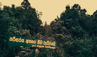
උෟව වෙල්ලස්ස සරසවි සිසුන් මෙහි අාරක්ෂාව වෙනුවෙන් මැදිහත් වී අැති බව පෙනුණි.වන සංරකෂණ දෙපාර්තමෙීන්තුව විසින් සංරක්ෂණය කල යුතු ජෙෙව කලාපයක් බව අපගේ හැගීමයි.'
මෙහි සංචාරය කරන ඔබ රැගෙන යන පොලිතින් හා ප්ලාසටික් නැවත රැගෙන ඒ්ම මගින් ඒහි ජෙෙවවිවිධත්වය තවදුරටත් අාරක්ෂා කරගත හැකිය.
මෙහි සංචාරය කරන ඔබ රැගෙන යන පොලිතින් හා ප්ලාසටික් නැවත රැගෙන ඒ්ම මගින් ඒහි ජෙෙවවිවිධත්වය තවදුරටත් අාරක්ෂා කරගත හැකිය.
Tuesday, August 30, 2016
Subscribe to:
Comments (Atom)

